Kiggsia
Petty Officer 3rd Class
- Joined
- Sep 18, 2008
- Messages
- 98
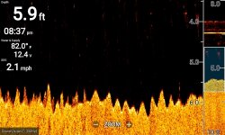
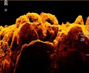
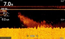
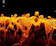
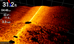
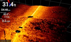
I am using my new fishfinder a lot looking at bottom structure on the western end of Lake Erie and Green Island. Might anyone know what the ragged bottom contour near Maumee Bay State Park is in the first attachment? And in the more ornate images just off Green Island northeast point, are these rock formations mainly or all different types of underwater vegetation? And is the third attachment with the fuzzy image just a sunken log, a giant Catfish, or, as a pal suggested, a giant swarm of Mayflies emerging from the mud?