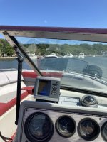
It’s important for people to realize what happens when you change the size of your viewing area you lose hazards like rocks & wrecks. Not possible with conventional charts….
It’s an education issue, not a chart problem.
Your changing the scale of the map when you zoom an electric map. No different than hanging the paper map on the wall then taking 15 steps back to read the detail
Nobody would try to read the wall map at 15 paces. Why would anyone run around with their electric map zoomed out to “15 paces”?
I’m rarely if ever zoomed beyond a mile. Usually a couple hundred yards or so at best.
Biggest difference is convenience. Everything is at my fingers tips. No chart book, no reading glasses and no course plotting. Select a point on the map and push the “navigate” button.


