DECK SWABBER 58
Lieutenant Commander
- Joined
- Aug 14, 2009
- Messages
- 1,913
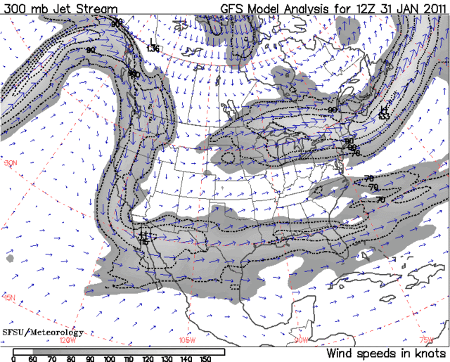
Massive Winter Storm to Sweep Much of Nation This Week In a winter that's becoming known for powerful storms, the one that's about to form might be the most impressive yet in terms of size and scope -- affecting much of the eastern two-thirds of the country during the first half of the week.
Heavy snow, ice, rain, thunderstorms and bitter cold will occur along the storm's path, with the likelihood of widespread travel interruptions, power outages and property damage. The storm might even reach blizzard strength in the upper Midwest, including Chicago, from Tuesday into Wednesday.
The storm has yet to become organized, but the ingredients will be in place for rapid formation once the low pressure system begins to emerge from the Rockies on Monday. The huge temperature difference between the northern Plains and Gulf Coast will be fuel for the storm as two systems merge in the middle of the country.
By early Tuesday, precipitation will likely extend from the eastern Rockies to the northern mid-Atlantic coast, with the most intense portion of the storm developing in the southern Plains. This low-pressure system will track from the Missouri Valley on Tuesday evening to off the New England coast by Wednesday evening.
More than a foot will fall on the northern and western sides of the storm, from the Plains and Missouri Valley through the Midwest and into northern New England. A corridor of accumulating ice will occur near the track of the storm, from the Missouri Valley through the Ohio Valley and into parts of the mid-Atlantic region.
As of Sunday afternoon, a blizzard watch was in effect for northern Illinois, including Chicago, extreme southern Wisconsin and northwestern Indiana. Winter storm watches extended from Oklahoma to southern Michigan, including the cities of Kansas City, St. Louis, and Detroit.
The precise track of the storm will determine the type of the precipitation for the major cities along the Eastern Seaboard, which have been pounded with several storms already this season. The National Weather Service is currently expecting a mixture of snow, ice and rain in New York City, Philadelphia and Washington, D.C., with a mixture of snow and ice in Boston.
Bands of rain and thunderstorms will occur south of the storm; the thunderstorms have the potential to reach severe levels, perhaps producing isolated tornadoes along the Gulf Coast on Tuesday and Tuesday night. The strong thunderstorms should remain to the north of central Florida, which was hit with damaging thunderstorms last week.
Winter weather advisories, warnings and wind chill warnings are currently in effect from Montana to Iowa and Minnesota for the northern part of the storm.
The very cold air in the northern Rockies and northern Plains -- temperatures will approach minus 30 in northern Montana on Monday night -- will move into the western part of the storm on Tuesday. Temperatures will be in single digits in the western Plains on Tuesday.
Temperatures will drop into the lower 20s even in Dallas by Tuesday night, with highs barely above freezing on Wednesday and Thursday. Temperatures late last week were in the middle 70s.
The bitterly cold air will not push as far south in the eastern part of the country, but by the second half of the week, sub-zero low temperatures are possible in parts of the Northeast.
Sasto, hope your enjoying this. :facepalm:

