Trying to find a location in the Gulf

BWR1953

Vice Admiral
Joined
Jan 23, 2009
Messages
5,925
Back in 2006, when I was living in Tampa, a co-worker took me out "about 12 miles" in the Gulf to go fishing. And we had great success!

I remember that the location had a very tall, fixed type channel marker there and the water was only 14 feet deep. I'd like to find that marker so that I can go back there. The marker was West of Hudson Beach, FL.

I've downloaded nautical charts onto Google Earth, but the links are broken, so I can't find anything.

I've been trying other software and websites, but no joy so far. :confused:

The best I've found so far is at NOAA Chart Display Services (NCDS) but I haven't been able to measure distance with that tool. And I don't know the nautical symbols either.

A little help? 🙃

I did find this, but have no clue. 🤷‍♂️

The red circle shows some kind of nav marker and the water depth is about right.
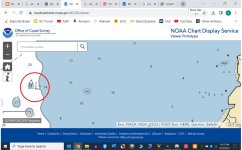
Gulf Marker.jpg
 

dingbat

Supreme Mariner
Joined
Nov 20, 2001
Messages
15,554
Back in 2006, when I was living in Tampa, a co-worker took me out "about 12 miles" in the Gulf to go fishing. And we had great success!

I remember that the location had a very tall, fixed type channel marker there and the water was only 14 feet deep. I'd like to find that marker so that I can go back there. The marker was West of Hudson Beach, FL.

I've downloaded nautical charts onto Google Earth, but the links are broken, so I can't find anything.

I've been trying other software and websites, but no joy so far. :confused:

The best I've found so far is at NOAA Chart Display Services (NCDS) but I haven't been able to measure distance with that tool. And I don't know the nautical symbols either.

A little help? 🙃

I did find this, but have no clue. 🤷‍♂️

The red circle shows some kind of nav marker and the water depth is about right.
View attachment 390102
That's a unlighted fish trap or anchorage buoy.

Nav aides get moved, replace and removed all the time. Unless a fixed structure (light tower, nav buoy, etc.) good luck finding an unidentified marker in open water from 20 years ago.
 

cptbill

Senior Chief Petty Officer
Joined
Oct 6, 2012
Messages
745
10 miles out is pasco reef # 2, I forget the # for the one that's at 12, but 4 reefs reefs have been made fairly close to each other out there
 

BWR1953

Vice Admiral
Joined
Jan 23, 2009
Messages
5,925
10 miles out is pasco reef # 2, I forget the # for the one that's at 12, but 4 reefs reefs have been made fairly close to each other out there
Thanks. Are there large markers there?

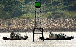
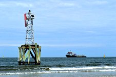
The one I remember is sorta/kinda like these two. Very substantial. I remember that it really towered over the boat. If I could find it on a chart, that would be awesome. :sneaky:

Example marker #1
channel marker 1.jpg

Example marker #2
channel marker 2.jpg
 

flashback

Captain
Joined
Jun 28, 2002
Messages
3,734
There are millions of artificial reefs in Florida, and most offer good fishing if we don't advertise too much!
 

Scott Danforth

Grumpy Vintage Moderator still playing with boats
Staff member
Joined
Jul 23, 2011
Messages
47,700
sailboats come into harbors all the time with channel markers hanging from the bow pulpits all the time. most markers from 2006 would have been replaced by now. especially with the hurricanes that have come thru in the past 17 years

I have a list of fishing spots a charter bud of mine gave me.

I also use this. https://www.nauticalchartsonline.com/charts/NOAA/Gulf-Coast
 

BWR1953

Vice Admiral
Joined
Jan 23, 2009
Messages
5,925
sailboats come into harbors all the time with channel markers hanging from the bow pulpits all the time. most markers from 2006 would have been replaced by now. especially with the hurricanes that have come thru in the past 17 years

I have a list of fishing spots a charter bud of mine gave me.

I also use this. https://www.nauticalchartsonline.com/charts/NOAA/Gulf-Coast
Are you talking about channel markers like I showed in Post #4 above?
 

BWR1953

Vice Admiral
Joined
Jan 23, 2009
Messages
5,925
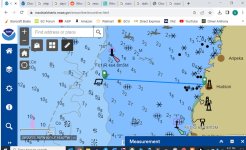
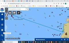
Okay, I got an online NOAA chart to work. (Finally.) :sneaky:

I see a rectangular mark by the left green line arrow. It's about the right distance. I'm searching to find out what it means. Anybody know off the top of their head? 🤷‍♂️

And the depth marks on the chart are throwing me off. I'd expect either feet or fathoms, but it seems like it's meters? I know that the depth out that way is 12 to 14 feet or so, but the chart is showing 4.5.

Hudson Bch chart.jpg
 

BWR1953

Vice Admiral
Joined
Jan 23, 2009
Messages
5,925
I found that the parallelogram is actually a floating buoy, so that's not it.

Am now searching for the rectangle with the triangle on top. I know it's a light of some type.

This stuff isn't needed on the 450 acre bass lake where I fish! :LOL:
 

BWR1953

Vice Admiral
Joined
Jan 23, 2009
Messages
5,925
I think I've figured it out! :D

This new pic shows that the vertical rectangle is about 12 miles from Hudson Beach at about 285 degrees on the compass. And the depth is 2.2, which is 2.2 Fathoms, or about 13 feet. So distance, direction and depth all add up.

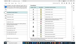
And the chart symbol for that vertical rectangle with the little cross at the bottom is for a "Minor Lateral Beacon."
chart symbols.jpg


The descriptor term Fl(1)R4s4.8m5M below the beacon on the chart decodes as follows:
Fl(1)R4s4.8m5M
Fl = flashing
(1) = Number of lights
R = red
4s = rate of flash, once every 4 seconds
4.8 m = height above the water in meters. In this case 15.75 feet
5M = visibility in miles. For this beacon, that’s 5 miles.

I think I've found it! 😁

Hudson Bch chart2.jpg
 

Scott Danforth

Grumpy Vintage Moderator still playing with boats
Staff member
Joined
Jul 23, 2011
Messages
47,700
Are you talking about channel markers like I showed in Post #4 above?
depends on the size of the boat.

I was referring to the ICW markers.

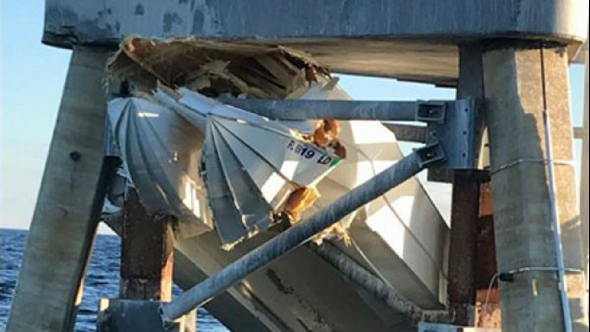
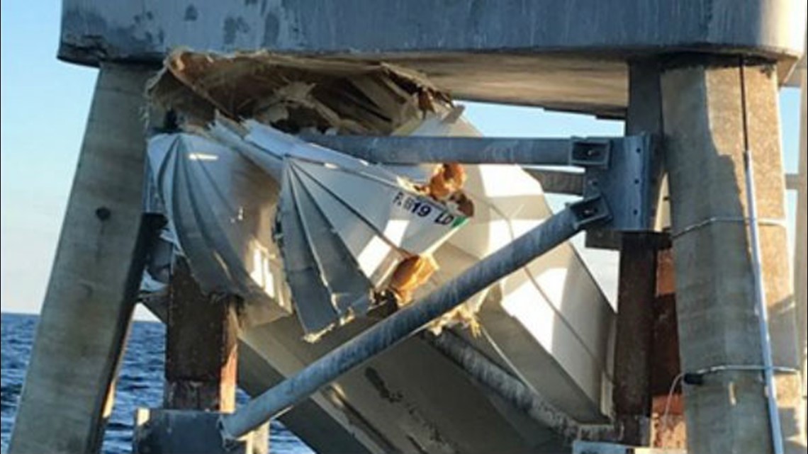
however the markers you posted in post #4 usually will take out the hull of most recreational boats.

604142314_1920x1080.jpg


cptbill

Senior Chief Petty Officer
Joined
Oct 6, 2012
Messages
745
That rectangle is a bunch of white marker buoys, that a fish sanctuary I believe, and yes 3.5 miles before you get to 8ft of water
 
Top