Active Captain / Garmin Blue Chart

southkogs

Moderator
Staff member
Joined
Jul 7, 2010
Messages
14,919
Anyone using these? Thoughts? Worthwhile for inland boating at all?

Thanks.
 

saumon

Lieutenant
Joined
Aug 2, 2004
Messages
1,452
Re: Active Captain / Garmin Blue Chart

Did you mean both togheter? Or individually.

Never used ActiveCaptain but heard it's great for trip planning, and free.

I use the Garmin BlueCharts for years (inland) and like them, but what I like the most is the ease of use, simplicity and robustness of their charplotter units. I have to admit that in the last year or so, their direct mapping competitor, Navionics, came with a very interresting and refined product, the SonarCharts, that can be used with the newer Lowrance/Humminbird units...
 
Last edited:

southkogs

Moderator
Staff member
Joined
Jul 7, 2010
Messages
14,919
Re: Active Captain / Garmin Blue Chart

Did you mean both togheter? Or individually.
LOL ... I'm kinda' clueless enough about 'em to not know. So, either or I suppose.

I actually didn't realize Active Captain was free. I'll have to play with it some (I don't like blindly downloading stuff).

I was wondering how the charts were on the Garmin app if you used it on a smartphone? I don't need a plotter or anything on my boat, and my GPS works just fine, but doesn't have depths on it (unless I spend money on maps). I was curious if buying the Garmin stuff and running it on a smart phone was worthwhile?
 

Star

Chief Petty Officer
Joined
Sep 21, 2010
Messages
481
Re: Active Captain / Garmin Blue Chart

If you have a unit that uses SD chips you may be able to get some localized maps at a good discount. under $130
 

southkogs

Moderator
Staff member
Joined
Jul 7, 2010
Messages
14,919
Re: Active Captain / Garmin Blue Chart

According the Garmin site, my GPS won't work with the water charts. I'd have to buy a different unit. I'm not overly jazzed about putting a bunch of money into this as I'm mostly boating in places I know pretty well. Occasionally, I'll go somewhere I'm not familiar with and in those cases I'd like something with me. Hence the mobile stuff looked kinda' attractive.

From the looks of it though BlueChart Mobile hasn't been well received.

Looking at Navionics mobile now. Anyone got thoughts on that?
 

MH Hawker

Vice Admiral
Joined
Jul 13, 2011
Messages
5,516
Re: Active Captain / Garmin Blue Chart

Garmin missed the boat big time on their maps by not making them to work on the car units.
 

southkogs

Moderator
Staff member
Joined
Jul 7, 2010
Messages
14,919
Re: Active Captain / Garmin Blue Chart

^^^^ Yeah, I was really disappointed that it wouldn't work. I can use it for basic way finding, but no charts or depth information. Here in TN on the impounds it is generally no big deal, but there are a couple of lakes where the bottom will come up and getcha'. And we make bottoms outta' rock here!
 

saumon

Lieutenant
Joined
Aug 2, 2004
Messages
1,452
Re: Active Captain / Garmin Blue Chart

I'm a Garmin fanboy for their chart plotters /mapping but they still didn't make the BlueChart app for android, it's only available for the iPhone. The Navionics app is great and a steal at $10!
 

southkogs

Moderator
Staff member
Joined
Jul 7, 2010
Messages
14,919
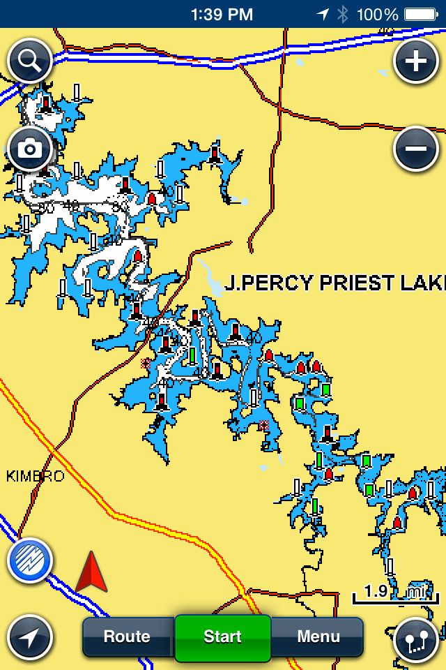
I thought I'd come back to this and say the Navionics app is pretty slick. What I needed was really a simple depth chart and basic GPS - didn't need a lot of fancy stuff as I'm pretty familiar with the area, and am in a smaller boat. Percy Priest Lake here in the Nashville area has some pretty shallow areas and a considerable amount of hazards on the south end, so the charts help quite a bit if I'm on a portion of the lake I'm not familiar with ... but it provides the same thing for nearly any inland waterway.

It gives you a decent map, though on a small screen like my iPhone (don't really want the iPad out on the boat) it's a little tough to read:


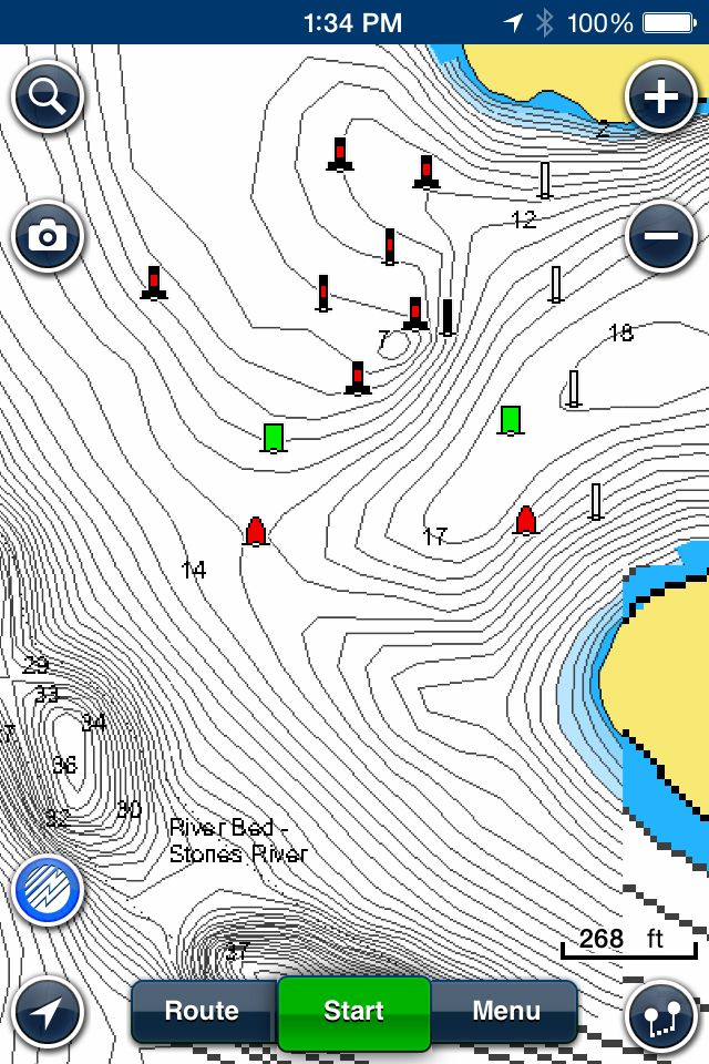
But zooming into the area of the lake you're on, it does give you good detail:


En route, it does show your position and will post your current speed.
 

southkogs

Moderator
Staff member
Joined
Jul 7, 2010
Messages
14,919
I went ahead and tracked my last run out with it. Kinda' cool:


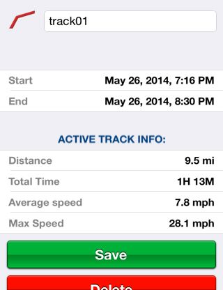
It tracks the whole trip, time out, max speed, average speed, you can have it track GPH burned and distance run. But you can also download the track and pop it into your Garmin software or Google Earth:

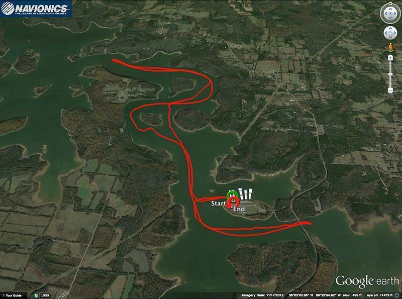
Here's my whole track on Percy Priest Lake:


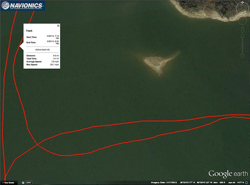
While in Google Earth, I can tap the track and get some details about the track:


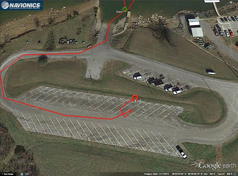
And it's pretty accurate, I can't quite figure out the "squiggle" here at the end of the track ... but I's got us in the right parking space while we de-rigged. Though we didn't park in the grass:


Anyway ... for ten bucks it's a pretty nifty gizmo and seems to work well with the iPhone.
 

ssobol

Chief Petty Officer
Joined
Sep 3, 2010
Messages
503
Active Captain plots user supplied information onto a map. Some apps (like MxMariner) plot the Active Captain markers on the nav charts. Active Captain provides info on marinas, obstacles, restaurants, anchorages, POI's, etc., that users find on their voyages. It is useful for things like seeing a marina ahead on the chart and providing info on fuel prices, dockage, facilities, contact info, and user reviews. This can help you decide if you want to go there or not.
 
Top