Got lost on the water this weekend.

roffey

Commander
Joined
Nov 22, 2012
Messages
2,191
Hey SailorDon, I had a Humminbird GPS in my old boat and it did every thing, water temp, speed average speed, time on the water and the route you took plus what ever you marked, and did the sonar thing for the fish. I remove it when I sold the boat. My problem was or is my boat is brand new and I just did not have the heart to drill a hole in the boat. The application on my phone will keep me out of trouble but does not work as well as the Humminbrid. I have memory for the unit so I can download maps for any area and Bobs lake is a huge lake with over 500 miles of shore line. I think in your neck of the woods it a lost of rivers and such
 

SailorDon

Cadet
Joined
May 2, 2013
Messages
17
I have memory for the unit so I can download maps for any area and Bobs lake is a huge lake with over 500 miles of shore line. I think in your neck of the woods it a lost of rivers and such

I live on Lake Livingston in Texas. It has 450 miles of shoreline, is 17 miles long, and 10 miles wide.
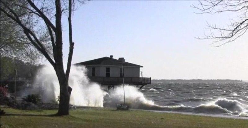
It can get pretty nasty when the wind blows. This photo is from 2 years ago.


Based on those statistics, that isn't all that much different than Bobs Lake. 95% of my boating is on Lake Livingston. When boating after dark, it is necessary for me to navigate by my GPS. There are no reliable aids to navigation in the dark.

Since you had the Humminbird GPS, why didn't you hook up the GPS feature? No thru hull fitting required for that. The features like water temp, depth finder and speed through the water wouldn't work, but you have GPS speed, location, and whatever charts and navigation you entered of the previous year in your previous boat. That's really all you need to get home safely.
 

roffey

Commander
Joined
Nov 22, 2012
Messages
2,191
You are right about the gps but I did not want to mess with the dash of the boat and I thought I could navigate the lake with out it. This is my first new boat and I most likely baby it to much, if that's possible. I grew up on a lake that was 10 miles long and maybe 1/4 mile wide, nothing like Bobs lake at 26 miles long and 1/2 mile at the widest. If we had water like in your picture I would head home with my tail between my legs for sure, LOL. My boat is a 20 foot bow rider Stingray a lake boat for sure.

What I meant by rivers is they are a lot longer and harder to navigate, I used to boat on the Rideau river. If you google it you will see it was created to bypass the st lawrence seaway when we was scrapin, lol. and is hundreds of miles of water.

Here is my place, my first attempt on a you tube video, most likely my last, LOL.

https://www.youtube.com/watch?v=dxbvc49XR_M
 

NAT1VE

Petty Officer 2nd Class
Joined
Aug 7, 2015
Messages
116
Just a tip, like mentioned above about the "Mental photograph". If you're carrying a smartphone, guarantee it has a camera. Take a picture of the shoreline, or passage way you came out of rather than trying to go off memory.
 

roffey

Commander
Joined
Nov 22, 2012
Messages
2,191
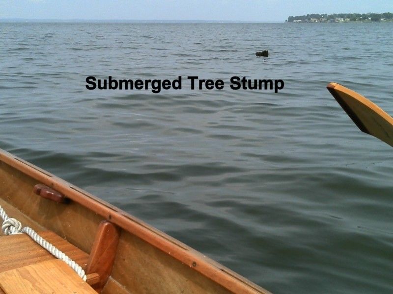
or, just take smaller trips and get to know what is under your boat. Stumps and dead heads are not marked.
 

Stachi

Lieutenant Commander
Joined
Jul 14, 2009
Messages
1,671
I never leave my dock without my Garmin ! I am severely nearsighted....visual land sightings and way points are NOT an option for me !
 

SailorDon

Cadet
Joined
May 2, 2013
Messages
17
or, just take smaller trips and get to know what is under your boat. Stumps and dead heads are not marked.
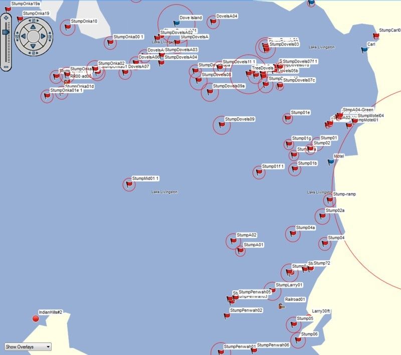
On many GPS units, you can mark stumps, dead heads, and other obstructions which are not on published charts.
For example, this is a small section of Lake Livingston which is my home port.


The red flags with labels are all submerged tree stumps that I have entered from visual sightings.
It is like navigating through a mine field. They may not explode when you hit them, but it sure can run a boating trip.


roffey

Commander
Joined
Nov 22, 2012
Messages
2,191
I can do that on my phone as well. I was told the only thing the GPS will do is water temp and fish finder. Don't get me wrong, if I were hitting big water and using the GPS more often I would have one permanently installed. I use the GPS on my phone rarely these days as I know the water much better.
 
Top