Attention Lake Lanier boaters using GPS/Chartplotter

Status
Not open for further replies.

HeadnSouth

Seaman
Joined
May 15, 2005
Messages
74
I recently bought a Garmin 536S and tried Lakes vision and LakeVu HD. Neither show much information that I'm looking for.

What I'd like from a unit is names of land masses/islands and the names of creeks. It seems to be a tall order for something that on an auto GPS is a given.

Any suggestions on a unit that will do that?
 

eavega

Lieutenant
Joined
Apr 29, 2008
Messages
1,377
Re: Attention Lake Lanier boaters using GPS/Chartplotter

The only solution I found was to create my own GPS maps on my Magellan Triton from the free PDF charts that COE provides on their website. There was a tool called the RMPmake. It creates what is called a "Raster Map" which is a fancy way to say a map from a picture) I took each page (I want to say there are 23 or 26 of them) and ran it through software that orient the map based on Lat-Long coordinates ( you identify 3-5 Lat-long points on the map, the more points, the more accurate the maps are), then I merged each individual map into one large map that my GPS unit accepts. I don't know if this only works with Magellan units. If your unit has the ability to accept Raster Maps, I can send you my map file and see if it works. Those maps definitely have all the named islands as well as the creek names. Bonus is that it has all the COE parks, county parks and boat ramps also listed.

Rgds
Eric
 

HeadnSouth

Seaman
Joined
May 15, 2005
Messages
74
Re: Attention Lake Lanier boaters using GPS/Chartplotter

Wow, that seems like a lot of work for something that to me should already be loaded. I appreciate the offer for you maps but
I returned the unit today. For the money I paid for it I can get a hand held or a app for my phone for a whole lot less money and do Just about the same thing.
I have garmin nuvi 780 that I may try loading marine maps to.
 

Star

Chief Petty Officer
Joined
Sep 21, 2010
Messages
481
Re: Attention Lake Lanier boaters using GPS/Chartplotter

My old garmin gps/maps 398 came with all the lakes, rivers, and state parks. it wasn't a great finder. But it had enough road info that I used it in my car for 7 years it was GREAT. The bad news is that someone stole it out of my car and they don't make anything like it!!!
Looking for an old working 398.
 

HeadnSouth

Seaman
Joined
May 15, 2005
Messages
74
Re: Attention Lake Lanier boaters using GPS/Chartplotter

I've got an old 780 that I'm going to load lake maps to. I'll let you know how it works out.
I have another 780 (my sons) that he no longer uses. If it works out and you're interested I'll sell it.
 

UncleWillie

Captain
Joined
Oct 18, 2011
Messages
3,995
Re: Attention Lake Lanier boaters using GPS/Chartplotter

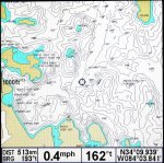
Here is a screen shot of the area by the Dam from an HB798 with a Navionics HotMaps Premium Card installed.
What say ye!

LakeLanier.jpg
 

HeadnSouth

Seaman
Joined
May 15, 2005
Messages
74
Re: Attention Lake Lanier boaters using GPS/Chartplotter

What's an HB798? What's the price of the card?
 

GA_Boater

Honorary Moderator Emeritus
Joined
May 24, 2011
Messages
49,038
Re: Attention Lake Lanier boaters using GPS/Chartplotter

A suggestion - Join the Georgia Outdoor News forum and ask in the Freshwater Fishing section. Plenty of Lanier guides and fishing folks that can advise you. Georgia Outdoor News Forum - Powered by vBulletin

HB798 is a Humminbird unit and the cards go for $100 up depending on which one you get.
 

HeadnSouth

Seaman
Joined
May 15, 2005
Messages
74
Re: Attention Lake Lanier boaters using GPS/Chartplotter

Thanks I'll have a look at GON.
 

GA_Boater

Honorary Moderator Emeritus
Joined
May 24, 2011
Messages
49,038
Re: Attention Lake Lanier boaters using GPS/Chartplotter

They won't share their secret fishin' holes. :D But they are a helpful bunch and are familiar with Lanier. Good luck.
 

BULLWARKS

Petty Officer 1st Class
Joined
Mar 22, 2005
Messages
257
The Garmin Tec Support says the new version has the tributary labels. I'll let you know whe I get it. It's really frustrating to pay for a new GPS Map and HD Lake card and not have the BASIC information. It's got all kinds of very detailed information except that.
 

GA_Boater

Honorary Moderator Emeritus
Joined
May 24, 2011
Messages
49,038
This thread is old enough that any map info it is outdated. 2 years is a long time in the fishing map business.

Thanks for a good info update, but we'll put the book back on the library shelf for future reference.

Closed.
 
Status
Not open for further replies.
Top